Our Protected Land Profiles
A Living Legacy
Public concern for greater land conservation in the upper Deep Creek watershed was awakened in 1992 by an unpopular 300-acre subdivision proposed in the scenic stream basin near Running Springs. The challenge to protect Deep Creek led to the formation of a citizen group called the Deep Creek Open Space Coalition in April 1993, out of which the creation of the San Bernardino Mountains Land Trust evolved in 1995.
The protected lands described below are all linked to a renewed conservation focus that gave birth to the San Bernardino Mountains Land Trust (SBMLT), which has continued to build momentum with every new land acquisition that increases the overall protection of our popular national forest. The process has brought together many partners in a movement in which the United States Forest Service (USFS), state agencies, elected representatives and other regional and national land trusts have coordinated to achieve impressive results.
Bautista Canyon (680 acres)
Bautista Creek, which flows through the canyon of the same name, contains significant riparian habitat that supports a population of Arroyo toad, one of the critical endangered species found in the San Bernardino National Forest. Because only one percent of the SBNF landscape consists of riparian habitat (but 70 percent of all wildlife depends on it for survival), protecting as much of this habitat as possible in public ownership is a major priority for the USFS.
Major land acquisitions in Bautista Canyon, which lies west of the San Jacinto Mountains, were made possible by the on-going letter-writing campaign by the San Bernardino Mountains Land Trust to request forest service purchase funds from the federal Land and Water Conservation Fund (LWCF). Momentum from prior successful LWCF projects in Deep Creek and Garner Ranch helped focus atttention on the conservation needs of the San Bernardino National Forest. Between 1998 and 2001, the USFS was able to complete six land purchases totaling 680 acres in Bautista Canyon by using appropriations that were steadily obtained from the congressional Land and Water Conservation Fund.
Bluff Lake (120 acres)
Upon learning that Bluff Lake was for sale, after being a YMCA camp for 50 years, SBMLT contacted the Wildlands Conservancy (TWC), knowing the organization was a strong supporter of forest youth camps. SBMLT created a detailed property profile and encouraged TWC to visit the property. It is one of the most scenic spots in the San Bernardino Mountains, having been featured in several movies, such as The Parent Trap. The Bluff Lake camp was purchased soon after by the Wildlands Conservancy in October 2000. It features Southern California’s finest example of an intact mountain marsh and meadow complex, which is home to several federally protected plant species, including the Bear Valley bluegrass, Big Bear checkerbloom and California dandelion. Surrounding the meadow are mature forests of lodgepole pine, Jeffrey pine, and white fir. The champion lodgepole pine in North America is located a short distance from the lake on forest service land.
Broom Flat (90 acres)
Surrounded by National Forest land, this inholding--located at Broom Flat north of Onyx Summit and east of the Big Bear Valley--was acquired by the Forest Service in September of 2002 using funding from the Land and Water Conservation Fund. The area contains rare pebble plain habitat.
Cajon Ridge North (180 acres)
 The Cajon Ridge North property was purchased by SBMLT from a partnership of five owners in December 2010 after taking a year to sort out several complicated issues between the multiple owners. Together with the neighboring private parcel to the south, these properties comprise part of a critical landscape that channels animal migration through the major wildlife linkage between the San Gabriel and San Bernardino Mountains at the Cosy Dell underpass. The San Bernardino Mountains Land Trust plans to hold these properties until such time as they can be transferred to the Forest Service.
Cajon Ridge South (80 acres)
 The Cajon Ridge South parcel is adjacent to a larger parcel on the north (described above). Both are part of a significant ridge descending into Cleghorn Canyon. The canyon connects with a major underpass below the Interstate 15 freeway at Cosy Dell, providing the main wildlife linkage for larger animals to travel between the San Gabriel and San Bernardino Mountains. This key inholding was purchased by the San Bernardino Mountains Land Trust in December 2010 with the goal of protecting the wildlife access to the Cosy Dell linkage from potential future interference.
Carrizo Creek (640 acres)
The Carrizo Creek property was acquired by the Forest Service with LWCF funds in 2009 in a transaction facilitated by the Friends of the Desert Mountains, a partner land trust land trust in the San Jacinto Mountains in the San Bernardino National Forest. The property is located northwest of the small Pinyon Crest community in an area consisting mainly of Peninsular juniper woodland and scrub. The site is within the critical habitat for the endangered Peninsular bighorn sheep and contains the headwaters of Carrizo Creek, which flows downstream through the Carrizo Canyon State Ecological Reserve. The silvery legless lizard and the pallid San Diego pocket mouse, two rare species of concern, have been documented within the vicinity of the property.
Cosy Dell (51 acres)
 The Cleghorn Canyon underpass of the Interstate 15 freeway at Cosy Dell was identified by the South Coast Missing Linkages Project in 2004 as one of the major unsecured wildlife linkages in Southern California. It permits large animals to migrate back and forth between the San Gabriel Mountains and the San Bernardino Mountains.
In pioneer days Cosy Dell was a way station for travelers crossing the Cajon Pass. Later it was a gas station and trading post on Route 66. SBMLT helped the Wildlands Conservancy assess the site for potential acquisition and eventual transfer to the Forest Service. In 2006 the Burlington Northern-Santa Fe Railroad agreed to provide funds for purchase of the site as mitigation for adding a third rail line through the Cajon Pass. The land is presently held in TWC’s protected ownership, preparing for transfer to the Forest Service once the problems of outdated county liens against prior owners have been sorted out.
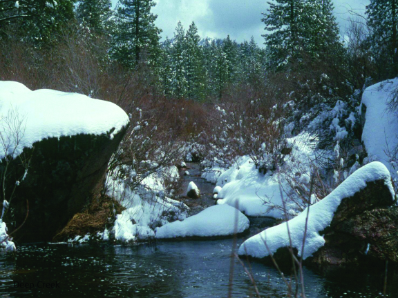
Deep Creek Headwaters (42 acres)
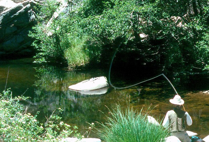
 In 2002, the San Bernardino Mountains Land Trust partnered with the California State Wildlife Conservation Board to accept a grant for purchasing a one-third interest in a 126-acre parcel located on Green Valley Lake Road. Deep Creek is the most scenic and popular trout fishery on the western half of the San Bernardino Mountains. Protecting the Deep Creek Watershed continues to be key priority for the SBMLT. At some point in the future SBMLT hopes to acquire the remaining two-thirds of the property so that it can be placed in the protective public ownership of the National Forest.
Dry Creek Acre (1.0 acre)
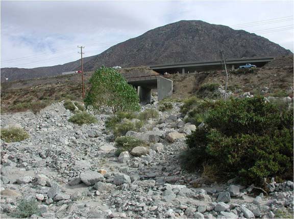
 This small property is located in Running Springs near the point where State Highway 18 crosses over Dry Creek. The site contains habitat for the southern rubber boa. The San Bernardino Mountains Land Trust purchased this 1-acre site at the County of San Bernardino’s Tax Sale Auction in 2000. The property was later purchased from SBMLT in 2009 by Caltrans as mitigation for the loss of southern rubber boa habitat during construction of a new bridge at the Big Bear Lake Dam. The land, which is adjacent to the 300-acre Upper Deep Creek acquisition of 1996, will eventually be transferred to the Forest Service.
Eagle Canyon (640 acres)
 Eagle Canyon became protected as part of a SAVE THE SAINTS Project, initiated informally by The Wildlands Conservancy, SBMLT and the Trust for Public Land to better highlight LWCF needs in three National Forests surrounding the greater Los Angeles basin. (Most of the mountains in the three Forests bear Spanish names for saints). TPL gifted the Eagle Canyon property to SBMLT in 2005 with an agreement that the land would be sold to the Forest Service whenever it became possible to obtain LWCF funds. The resultant proceeds would then go into a special SBMLT revolving acquisition account to facilitate the further protection of private inholdings in the San Bernardino National Forest. LWCF funds were successfully obtained in 2009, and the land was transferred to the Forest Service in December of that year.
The Eagle Canyon parcel was gifted to SBMLT by the Trust for Public Land along with Yaeger Mesa in 2005. Prior to selling the private inholding to the Forest Service in December 2009, SBMLT agreed to survey and verify the alignment of a recorded access easement that was attached to the land. The easement passes through a private avocado orchard situated between the eastern boundary of the National Forest and the end of the public roadway in front of the avocado ranch.
Eagle Ridge (Lake Arrowhead Ridge) (80 acres)
 The 80-acre Lake Arrowhead Ridge parcel is half of a larger property that was traded out of public ownership by the Forest Service in 1989, despite its many outstanding forest characteristics. Due to prior land exchanges of Forest Service tracts of summer lease cabins, the property was no longer contiguous with other National Forest land. While the trade away of this property was highly controversial and unpopular with the mountain community, public dismay became worse when a high-density development called Eagle Ridge was proposed on the site.
In 2008, after starting the construction grading of Phases I and II of an 8-phase subdivision, the developer defaulted. With no other development company willing to assume the risk of reviving the project during a prolonged economic recession, the San Bernardino Mountains Land Trust was invited to make an offer. After careful evaluation of the ten acres most impacted by grading, road layouts and wall construction; SBMLT completed a purchase of the site in April 2011. Having consulted with the local recreation and park district, it appeared there would be positive support for preserving the site as a wildland nature park.
Professional foresters consider the site to be the best example of a southern sierran mixed-coniferous forest found in the San Bernardino Mountains, and the vigorous growth and healthy diversity of species onsite affirm this fact. The site also helps preserve a critical link in one of the more significant wildlife corridors through the Lake Arrowhead area. SBMLT plans to complete a loop trail around the 80-acre perimeter of the parcel in 2012 so that the public might better appreciate the full splendor of this inspirational forest.
Frankish Peak (25 acres)
 With the help of the Trust for Public Land and LWCF, the Forest Service in 2004 acquired 25 acres at the far western edge of the San Bernardino National Forest. The property is part of a larger inholding known as Frankish Peak in the San Gabriel Mountains.
Garner Ranch (420 acres)
 The Garner Valley at the southwest base of the San Jacinto Mountains was named after the historic 2,000-acre cattle ranch established over a century ago by the Garner Family. It occupies a large montane meadow with various sensitive plant populations and important deer fawning grounds. Select parcels of the ranch have long been priorities for USFS acquisition.
Members of the Deep Creek Coalition (and founders of SBMLT) added the Garner Ranch to their persuasive congressional letter-writing campaign aimed at obtaining LWCF funds for the San Bernardino National Forest during the period of 1994 -1997. With the successful attainment of these funds, the USFS was able to purchase 155 acres of the Garner Ranch in May 1996. Another 26 acres were purchased in October 1996, followed by an additional 239
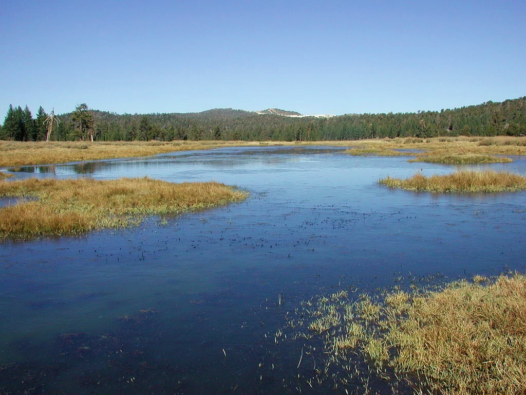
Grace Valley (183 acres)
 Grace Valley is the site of an exceptional and low-impact mountain camp. As with Bluff Lake, SBMLT provided a detailed property profile and encouraged acquisition by the Wildlands Conservancy. TWC purchased the 183-acre property in June 2002 from the Boys Club of Pasadena, which might otherwise have sold the land to another buyer for a trailer park. TWC later (in July 2003) placed the property in the ownership of the Los Angeles County Education Foundation with conditions that it be maintained as a nature-friendly youth camp. This scenic property --at a site named Cienaga Seca on the map (near Onyx Summit on State Highway 38) -- contains rare high-alpine meadow habitat that supports several unique plant and animal species.
Grass Valley Creek (156 acres)
 In February 2003 the Los Angeles Times newspaper did a profile about 91-year-old Charles Krause and his frustration in waiting for the Forest Service to purchase his large Grass Valley Creek parcel in Lake Arrowhead. Not until February 2007 did the Forest Service finally complete this difficult acquisition with the help of SBMLT.
With surplus LWCF funds left over, after negotiations failed on two Big Bear projects, Congressman Lewis encouraged SBMLT to help the San Bernardino National Forest use the unspent money to clear the path for future LWCF requests. At that time, it looked like the Krause project would be a very straight-forward transaction. Instead it took four and a half years to complete, largely because of conflicting boundary records and a major encroachment that had to be resolved by a lot line adjustment. The land is part of the Lake Arrowhead viewshed and contains a half mile of significant riparian habitat in Grass Valley Creek.
Gregory Property (120 acres)
 The 120-acre Gregory Property was acquired by the State Wildlife Conservation Board in 2001 from Bill Gregory, whose family had been long established in the area. SBMLT was the chief advocate for state funding, which was procured by Assemblyman Bill Leonard, a representative for the Lake Arrowhead area in the state legislature for many years. The property is located in Twin Peaks and is dominated by a mixed coniferous forest that supports habitat for the southern rubber boa and the California spotted owl. Prior to the loss of large numbers of ponderosa pines during the 2003 bark beetle infestation, the parcel featured a rare nesting site for a pair of bald eagles. It is now one of the most popular hiking areas in Twin Peaks.
Holcomb Valley (124 acres)
 Holcomb Valley lies approximately three miles north of Big Bear Lake, featuring unique montane meadowlands, rare plants, scenic forest and rich wildlife habitat. Old mining claims and homestead ranching in the 1860s created large inholdings of private land in this region of sensitive habitat, which now needs to be restored to the San Bernardino National Forest for optimum conservation protection. LWCF appropriations in 1998-1999 made it possible for the USFS to acquire two of the critical private properties in this area.
Johnson Ranch (352 acres)
The Johnson Ranch parcel is located on the east perimeter of the San Jacinto Ranger District south of the high desert community of Pinyon Crest. It is directly east of Sugarloaf Mountain (not to be confused with the mountain with the same name in Big Bear Valley), which lies on the northeast fringe of the Santa Rosa Mountains near State Highway 74. The property is within the critical habitat for the Peninsular bighorn sheep and drains into Deep Canyon. The landscape features Peninsular juniper woodland, scrub and red shank chaparral, which is prime habitat for the gray vireo. The property was acquired by the Forest Service in 2003 with the assistance of the Friends of the Desert Mountains.
Lion Peak (640 acres)
The 640-acre Lion Peak parcel is located on the ridge of the San Jacinto Mountains above the Coachella Valley and contains a one-mile stretch of the Pacific Crest Trail. The peak itself is 6,868 feet in elevation. This section of land contains the headwaters of Pipe Creek on the west and Oak Canyon on the east. The area is mainly characterized by pinyon-juniper woodland with some stands of ponderosa pine. The USFS acquired the parcel in February of 2001 with the help of the Friends of the Desert Mountains.
Lookout Mountain (480 acres)
Using LWCF funds the Pacific Crest Trail Association spearheaded the acquisition of 480 acres next to Lookout Mountain in 2003. As it reaches Lookout Mountain on it northward path, the PCT enters the San Bernardino National Forest adjacent to the Santa Rosa Indian Reservation at the southern boundary of the San Jacinto Ranger District, having ascended out of the Anza-Borrego Desert.

Mission Springs & Pacific Crest Trail (PCT) (1,210 acres)
 The properties listed below were acquired by the Forest Service in 2004 by utilizing LWCF funds administered by The National Park Service on behalf of the Pacific Crest Trail Association. Public ownership of these lands is essential to ensure greater protection of the Pacific Crest Trail against any threat of future development and potential adverse encroachment. SBMLT prepared detailed property profiles of Mission Springs and Onyx Summit for the Forest Service, compiled from site inspection-based field data and real estate records. This information, plus maps and photographs, was also provided to the Trust for Public Land which negotiated and managed the transactions.
Mission Springs (520 acres)
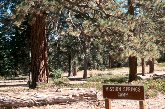 The Mission Springs parcel lies four miles south of Onyx Summit and is situated adjacent to the San Gorgonio Wilderness Area. When it was privately-owned, this inholding left a prominent gap in the public lands ownership of the surrounding pristine wilderness setting. The property features old growth Western Juniper, Jeffrey Pine and Mountain Mahogany mixed with pinyon, lodgepole and limber pine. The parcel contains the upper watershed of the North Fork of Mission Creek, featuring significant riparian habitat that supports populations of endangered arroyo toad and mountain yellow-legged frog.
Section 31 PCT (640 acres)
 A single Section of land separates Mission Springs from Section 31 on the east, where it lies within the San Gorgonio Wilderness. Here the Pacific Crest Trail enters the San Bernardino National Forest along the North Fork of Mission Creek, having ascended steeply uphill out of the Whitewater River basin on its northward route from the Mexican border to the Canadian Border.
Onyx Summit Pacific Crest Trail (PCT) I (40 acres)
 Summit region near State Highway 38 southwest of Onyx Peak in an area not where remote cabin development has become popular, supported by private wells, solar and propane in an off-the-grid community.
Onyx Summit Pacific Crest Trail (PCT) II (10 acres)
 This parcel of land was acquired as a separate purchase by the Forest Service, but is located in the same area adjacent to its sister parcel PCT I.
Palm Canyon (642 acres)
This section of land, traversed by Palm Canyon, is about three miles east of Lion Peak and about five miles NNW of the small community of Spring Crest on State Highway 74. Palm Canyon is a major drainage in the SANTA ROSA AND SAN JACINTO MOUNTAINS NATIONAL MONUMENT. A segment of the Palm Canyon Trail also crosses the property. The area is characterized by red shank chaparral. This private inholding, surrounded by the National Forest, was acquired by the Forest Service in 2007 with the assistance of the Friends of the Desert Mountains.
Strawberry Peak (50 acres)
 In February 2011 the San Bernardino Mountains Land Trust acquired 50 acres of the 160-acre forest property of the historic Pine Crest Lodge and summer resort. In 1946 the camp had been sold to the Assemblies of God Church. The SBMLT 50-acre site lies on the opposite side of State Highway 189 from the main camp and had long been an acquisition priority of SBMLT for over a decade with the goal of merging the property with the adjacent San Bernardino National Forest.
The site was previously the focus of a controversy over plans by the church’s Royal Ranger youth organization to construct an oversized conference center with major recreational facilities on the 50 acres. The irregular shape of the site as set against the adjacent National Forest is much like a missing puzzle piece on a map. The missing piece now needs to be fitted back into the National Forest. The land is part of a major wildlife corridor and is recognized by the California Department of Fish and Game to be prime habitat for the endangered southern rubber boa, a small nocturnal snake found only in the San Bernardino National Forest.
The site occupies the lower slope of Strawberry Peak, where one of the five USFS fire lookout towers for the San Bernardino Mountains is located. SBMLT purchased the land with the capital provided by its revolving land acquisition fund. The goal is to eventually transfer the property into Forest Service ownership.
Sugar Bush I (313 acres)
The Forest Service adds a Roman numeral “I” to the title of acquisitions, where future adjacent parcels are also expected to be acquired. This 2007 LWCF acquisition facilitated by the Friends of the Desert Mountains consisted of four separate parcels of 162 acres, 80 acres, 41 acres, and 30 acres. The protected lands are in the Pinyon area of the Santa Rosa Mountains, where the landscape primarily features Peninsular juniper woodland and scrub. If the land had not been added to the National Forest, the level terrain would have made it vulnerable to potential development.
Sugarbush/Asbestos Mountain (480 acres estimated)
Two properties southwest of Asbestos Mountain were acquired by the Forest Service in 2007. The Land is situated to the east of Palm Canyon and lies to the northwest of the small desert communities of Alpine Village and Pinyon Pines.
Sugar Pine Ridge (110 acres)
 After nearly 10 years of monitoring purchase opportunities for the Sugar Pine Ridge inholding (which is located south of Silverwood Lake and east of the Cajon Pass) and lacking funds to make an offer, SBMLT finally was able to acquire the land in May 2008. The area is a natural refuge for forest wildlife. Mountain lion, deer and bear all traverse the partially forested landscape that funnels into the major Cosy Dell underpass between the San Gabriel and San Bernardino Mountains. In September 2011 the Forest Service purchased the site from SBMLT and it became part of the National Forest.
Tayles Hidden Ranch (320 acres)
 The Tayles Hidden Ranch property in the Coon Creek territory between Onyx Summit and the San Gorgonio Wilderness is surrounded by scenic high country with tall forests and bountiful vistas of rugged Pipes Canyon and the snow-capped summit San Gorgonio Peak. The Pacific Crest Trail passes close to the property and may at a future time be re-routed through the parcel. The Pacific Crest Trail Association, SBMLT and the Forest Service worked together to add this land to the National Forest.
Timber Gulch (26 acres)
 The Timber Gulch parcel is an old mining claim located on an easterly slope above Lytle Creek. It is a small inholding that lies within the proposed expansion zone of the Cucamonga Wilderness Area. The parcel was acquired by the San Bernardino Mountains Land Trust from the county tax sale auction in 2009. Nearly ten years earlier, a partial owner had contacted the SBMLT about donating the property but was unable to readily clear title between other relatives and deceased part owners.
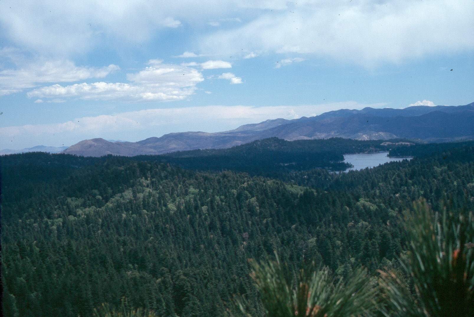
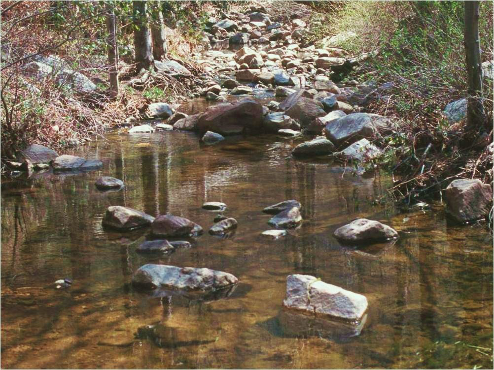
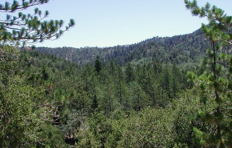
Upper Deep Creek Watershed (723 acres)
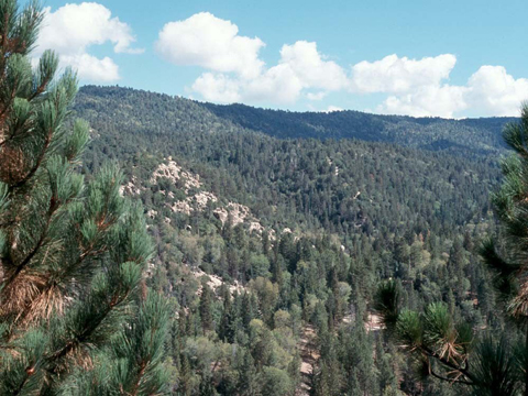 The upper Deep Creek watershed contains sensitive aquatic and riparian habitat. Deep Creek is a premier wild trout stream with valuable habitat for the imperiled California spotted owl, San Bernardino flying squirrel and southern rubber boa. It is also a major wildlife corridor as well as home to the beautiful lemon lily, which sometimes grows up to six feet tall.
Camp Awahanee Parcel (100 acres)
 The USFS made its first land acquisition in the upper Deep Creek watershed in April 1992. A 100-acre parcel of the 450-acre Camp Awahanee was acquired from the Boy Scouts of America as part of a land exchange with the lease-holders of forest recreation cabins in lower Crest Park. This acquisition stimulated fresh interest by the USFS in the Deep Creek area and set the stage for renewed community support that led to the forming of a local land trust.
Upper Deep Creek Parcel (300 acres)
 A major break-through in upper Deep Creek land protection was accomplished by the Deep Creek Open Space Coalition (a forerunner of the San Bernardino Mountains Land Trust) June 24, 1996, following three years of coordination with Congressman Jerry Lewis and the USFS in obtaining $2 million from the federal Land and Water Conservation Fund (LWCF) for the purchase of this critical 300-acre parcel. The San Bernardino Mountains Land Trust (SBMLT) obtained its nonprofit corporate status as a charitable land conservancy at the same as this success was achieved and a major new emphasis on critical land protection was initiated in the San Bernardino National Forest (SBNF).
Additions to the Upper Deep Creek Acquisition (323 acres)
To help expand the protected area in the sensitive upper Deep Creek region, the San Bernardino Mountains Land Trust and Deep Creek Coalition continued to work with Congressman Lewis to obtain additional funds from the LWCF program. Three additional properties, acquired from willing sellers with the assistance of the American Land Conservancy, were successfully added to the Sam Bernardino National Forest during the next two years.
Calvary Camp Parcel (98 acres)
 A 98-acre parcel directly adjacent to the 1996 upper Deep Creek acquisition on the northeast was acquired in May 1997 from Calvary Chapel of Costa Mesa, the new owners of the former Camp Awahanee, which was being upgraded from a primitive tent camp to a rustic-themed religious retreat.
Camp Helendade Parcel (124 acres)
In September 1998 the USFS took title to a 124-acre portion of the Helendade Boy Scout Reservation, where part of the upper Deep Creek watershed fell within the ownership of these private camp lands north of the 1996 acquisition site. The property was purchased from the Inland Empire Council of the Boy Scouts, which had originally received the full 160-acre site as a gift from Helen and Dade Davis, who bought large tracts of land in the Running Springs area in the 1920s.
Wilderness Road Parcel (101 acres)
The 101-acre Wilderness Road Parcel was purchased from Delores and Dr. John Lombardi, a land investor, and added to the San Bernardino National Forest in November 1998. This parcel includes a small tributary and segment of Deep Creek adjacent to Camp Helendade.
Upper Ranch Land Exchange (1,562 acres)
The Upper Ranch Land Exchange was started in 1998 and completed in 2003, resulting in three major acquisitions for the San Bernardino National Forest in the San Jacinto Ranger District. These transactions were handled by the American Land Conservancy as a continuation of its real estate assistance to the Forest Service, which began with the LWCF projects in the Upper Deep Creek area a few years earlier.
Healy (1,240 acres)
The two Healy properties are in the southeastern toe of the San Jacinto District of the San Bernardino National Forest about ten miles southwest of Palm Desert. One full section of land plus most of another section (minus 40 acres left out because of a communication tower) were acquired from the Healy Family. These parcels are located respectively to the north and to the northwest of Santa Rosa Mountain and lie within the newly established SANTA ROSA AND SAN JACINTO MOUNTAINS NATIONAL MONUMENT, which overlaps a large part of the San Bernardino National Forest. These mountains, featuring juniper woodland, scrub and red shank chaparral, are considered critical habitat for the endangered Peninsular bighorn sheep.
Grenzow (80 acres)
The 80-acre Grenzow property, acquired from the family of that name, is located in the San Jacinto Mountains directly east of Santa Rosa Mountain. It is in an area designated as critical habitat for the endangered Peninsular bighorn sheep. The property is dominated by juniper woodland and scrub and red shank chaparral. The USFS acquired the property on February 27, 1998.
Pinewood (242 acres)
The Pinewood parcel is four miles north of Idyllwild in the upper watershed of Fuller Mill Creek in the San Jacinto Mountains. It is also directly abuts the San Jacinto State Wilderness on the east. The property contains riparian habitat that supports some of the best mountain yellow-legged frog habitat in Southern California.
Valley Vista (23 acres)
 In April 1998 this 23-acre parcel of forest land was donated to the San Bernardino Mountains Land Trust by longtime owners, Mary and Lawrence Tollenaere of Pasadena. The property is located on State Highway 330 between the communities of Running Springs and Smiley Park. It occupies a south-facing slope vegetated predominantly by montane chaparral and featuring a panoramic vista of the lower mountain foothills and the San Bernardino Valley below.
Wildhorse Creek (273 acres)
 For many years Wildhorse Creek was an elusive private inholding, before being added to the National Forest in 2007. It is located between Big Bear Lake and the San Gorgonio Wilderness Area on the lower southwest slope of Sugarloaf Mountain near Heart Bar on State Highway 38. This scenic parcel includes outstanding riparian habitat and a popular equestrian and hiking trail. Partnering with the Trust for Public Land and the Forest Service, SBMLT compiled field data from site visits and research from real estate records to produce a detailed property profile with contact information, maps, photos and descriptions of critical environmental attributes. TPL provided its expertise in negotiating an option agreement and completing a LWCF transaction that transferred this parcel into Forest Service ownership.
Yaeger Mesa (186 acres)
 Yaeger Mesa became protected as part of a SAVE THE SAINTS Project, initiated informally by The Wildlands Conservancy, SBMLT and the Trust for Public Land to better highlight LWCF needs in three National Forests surrounding the greater Los Angeles basin. (Most of the mountains in the three Forests bear Spanish names for saints). TPL gifted the Yaeger Mesa property to SBMLT in 2005 with an agreement that the land would be sold to the Forest Service whenever it became possible to obtain LWCF funds. The resultant proceeds would then go into a special SBMLT revolving acquisition account to facilitate the further protection of private inholdings in the San Bernardino National Forest. LWCF funds were successfully obtained in 2009, and the land was transferred to the Forest Service in October of that year.
As part of the transaction, SBMLT agreed to construct a bat-friendly gate at the two openings of the 100-year-old Yaeger Mine, a 2,000-foot long tunnel through the mountain. The project was made possible by the leadership of experienced volunteers from the Southern California Grotto, a caving enthusiast organization. With the help of 40 volunteers, over 2,000 pounds of construction material and welding equipment was carried 1.5 miles up the mountainside by hand and assembled onsite. The planning and execution of this remarkable project was carried out on weekends over a two month period. Read about the Bat Cave Project.
Yucaipa Ridge (1,145 acres)
 Also in 2005 as part of the SAVE THE SAINTS Project, the Wildlands Conservancy deeded three large parcels on Yucaipa Ridge (between Oak Glen and Forest Falls) to the San Bernardino Mountains Land Trust to be sold to the Forest Service and to help build the SBMLT revolving acquisition fund. Earlier in the summer of 2003, the idea of protecting Yucaipa Ridge had been presented to representatives of Congressman Lewis at a SBNF Symposium. Congressman Lewis supported the idea and, by the time the Forest Service was prepared to purchase the property in 2006, had already designated LWCF funds for the project.
Yucaipa Ridge is one of the most rugged and wild parts of the local National Forest as it is interconnected with the tall peaks of the San Gorgonio Wilderness Area. At one time, the Forest Service was tempted to trade away its checker-board public lands on the ridge because they were interspersed with private lands of multiple ownerships. However, several strategic acquisitions by the Wildlands Conservancy along with SBMLT’s large land sale to the Forest Service have now guaranteed that this magnificent landscape will remain in conservation ownership.